DESTINATION CAPE HORN
DESTINATION CAPE HORN
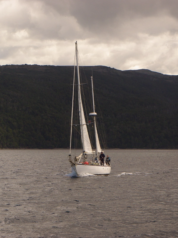
Sailing on the Ksar Sailboat to Cape Horn!
Cape Horn is the most legendary place in the world for all sailing enthusiasts. Managing to sail around it on a sailboat is one of the greatest achievements any sailor can imagine, given the enormous difficulty involved in the journey. Located at the southernmost point on Earth, Cape Horn offers an unparalleled experience for those looking to explore the most challenging seas.
NAVIGATION TO CAPE HORN
CAPE HORN DATA
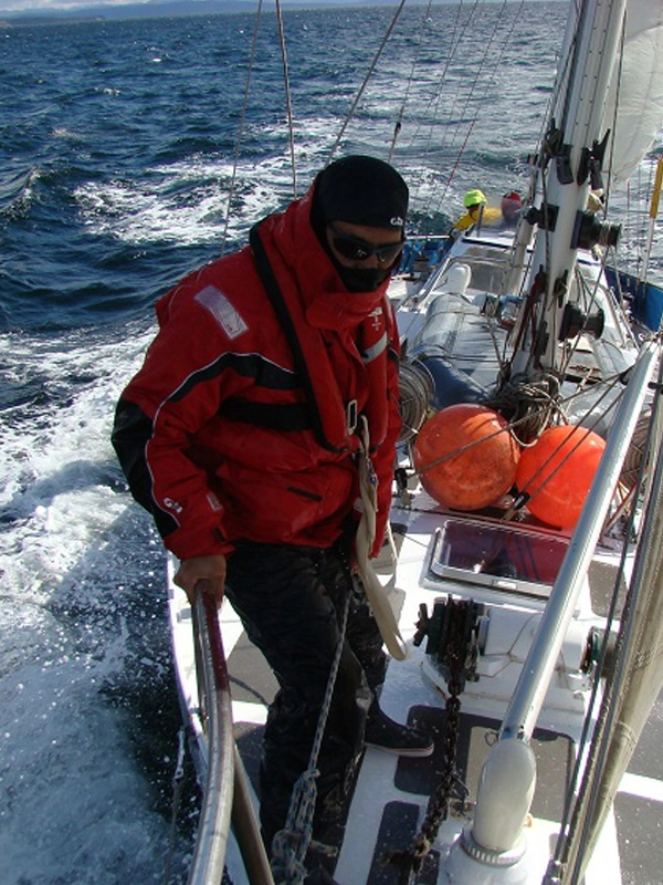
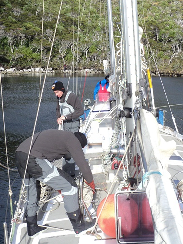
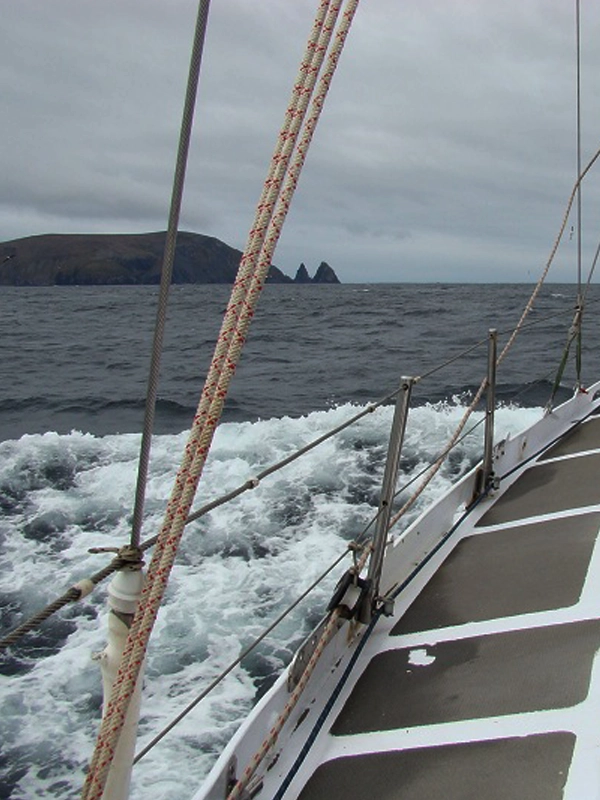
Sailing around the mythical Cape Horn aboard the Ksar Sailboat is an exciting and challenging adventure. Extreme weather conditions and turbulent waters make this journey an unforgettable experience for lovers of recreational sailing.
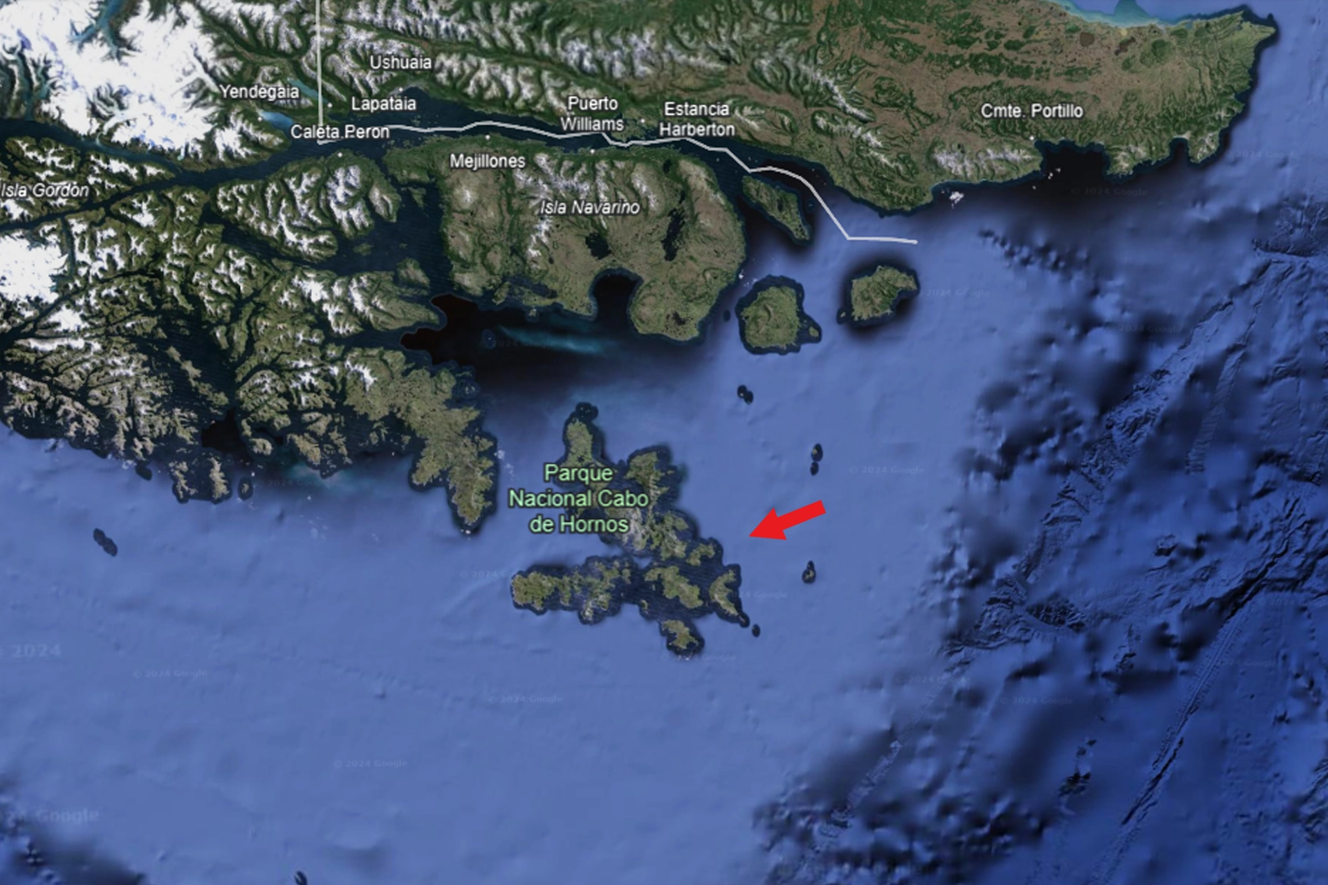
Cape Horn, also known as Kaap Hoorn in Dutch or Cape Horn, represents the southernmost point of Hornos Island and the Tierra del Fuego archipelago. Located in the southern region of Chile, it has historically been considered the southernmost point of America, although this title actually belongs to Águila Islet in the Diego Ramírez Islands, also under Chilean control. As one of the three great capes of the southern hemisphere, it marks the northern limit of the Drake Passage, connecting the Pacific and Atlantic Oceans and separating America from Antarctica.
Cape Horn is the southernmost point of land traditionally associated with South America. It is located at the southern tip of Hornos Island, the southernmost of the Hermite Islands archipelago, part of the Wollaston Islands (Chile) and the Chilean portion of the Tierra del Fuego archipelago.
For centuries, Cape Horn has played a crucial role in maritime trade routes, despite the dangerous conditions it presents, including strong winds, waves, and icebergs. However, with the opening of the Panama Canal in 1914 and the development of land-based infrastructure elsewhere on the continent, commercial navigation around the cape has significantly decreased. Today, the cape is primarily used by large ships that cannot pass through the canal, such as aircraft carriers or oil tankers.
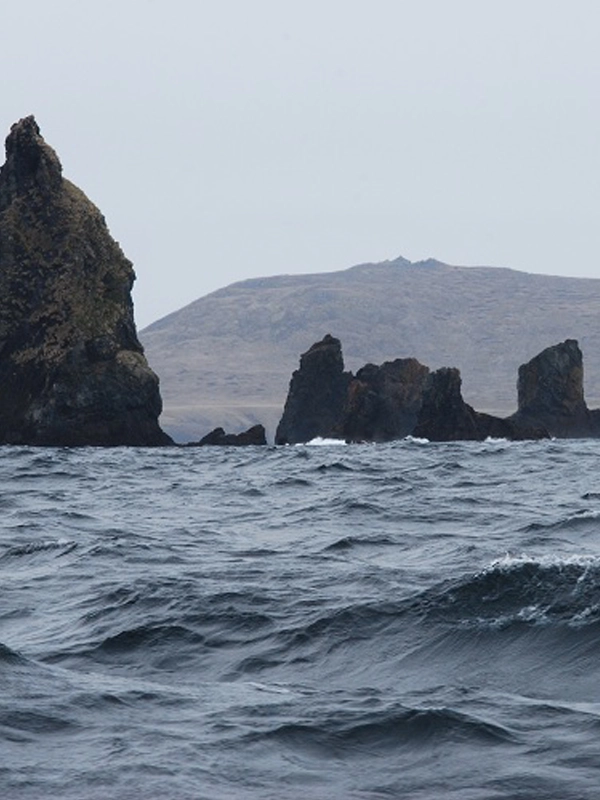
Navigating its waters remains an exciting challenge for sailing enthusiasts, with various sporting and tourist events taking advantage of this passage, including major yacht races like the Vendée Globe. The area around Cape Horn is known for its extreme conditions, with winds known as the «Roaring Forties,» «Furious Fifties,» and «Screaming Sixties,» as well as waves that can exceed 30 meters in the western region.
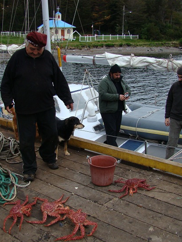
From Ushuaia, many sailboats on sports sailing journeys set off for Cape Horn, making a stop at Puerto Williams, Navarino Island (Chile), to complete necessary formalities. The region, with its notorious reputation and challenging waters, is monitored by the Chilean Navy, which maintains a watch station near the Monumental Lighthouse. The optimal months for crossing Cape Horn are December and January, although calms are also common, providing opportunities to visit the island and its surroundings.
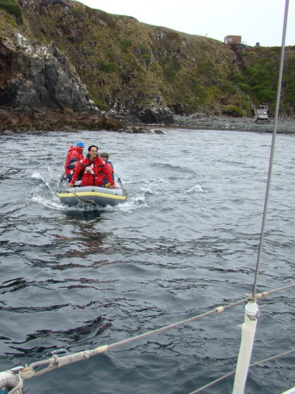
The anchorage at Hornos is equipped with buoys for mooring ships, located in a protected bay at the foot of a cliff. A staircase provides access to the Watch and Signal Post, where Chilean Navy personnel permanently monitor the area.
Desde Ushuaia, muchos veleros en travesías deportivas parten hacia el Cabo de Hornos, haciendo escala en Puerto Williams, Isla Navarino (Chile), para cumplir con las formalidades necesarias. La región, con su reputación tenebrosa y aguas desafiantes, es vigilada por la Armada de Chile, que mantiene un puesto de vigilancia cerca del Faro Monumental. Los meses óptimos para cruzar el Cabo de Hornos son diciembre y enero, aunque las calmas también son comunes, brindando oportunidades para visitar la isla y su entorno.
El fondeadero en Hornos cuenta con boyas para amarrar los buques, situado en una bahía protegida al pie de un acantilado. Una escalera permite el acceso al Puesto de Vigías y Señales, donde personal de la Armada de Chile monitorea la zona permanentemente.
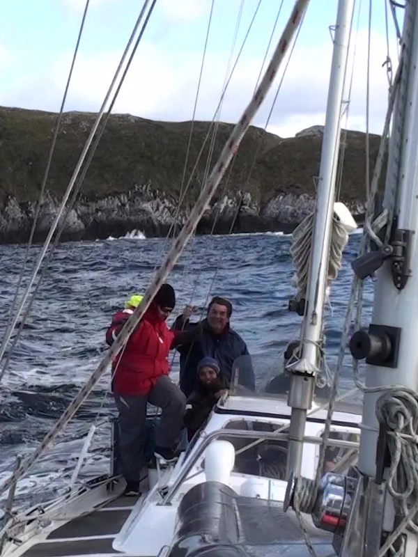
Sport sailing in the waters of Cape Horn represents one of the greatest challenges for sailors. Its extreme southern location at 56ºS, and its geography characterized by the scarce presence of land, impose exceptional conditions. These winds gain extraordinary strength due to the funnel effect, channeling their intensity through the Drake Passage between the Andes and the Antarctic Peninsula.
The landscape is characterized by the total absence of trees and a vegetative cover dominated by grasses, a result of the constant rains in the region. Additionally, Cape Horn is exposed to harmful ultraviolet rays that penetrate the ozone hole, especially concentrated in the southernmost part of the planet.
Since the first Europeans ventured into the seas surrounding Cape Horn, descriptions of its dangers have been legendary: hurricane-force winds, gigantic waves, and treacherous rocks. In such conditions, the slightest failure or any minor mistake can lead to disaster.
In this part of the province of Tierra del Fuego, recognized by UNESCO as a biosphere reserve, you can witness an impressive diversity of wildlife. From the Gentoo penguin to the Patagonian penguin, as well as majestic birds like the royal albatross, Cape Horn is a unique destination. Although uninhabited, the cape hosts a lighthouse, while on Hornos Island, another lighthouse and a small station are home to the watchman and his family. Additionally, a monument in the shape of an albatross pays tribute to the sailors who lost their lives in the attempt to reach this emblematic place.

YOU ARE READY?
Ask us
Don’t be left wondering what it’s like to travel on the Ksar Sailboat.
BOOKING
Book your trip in advance, so as not to be left out of season.
Browse
All ready! We are waiting for you to venture on the Ksar Sailboat expeditions.
Fulfill your dreams
DESTINATIONS IN BEAGLE CHANNEL
Ksar Sailing Trips around the mythical Cape Horn!